MAPS
PAGE
The following are historical
maps and a link to current Epsom tax maps:
Epsom
Plot Map
of all original proprietor's drawn lots with names of original owners
and occupants in 1800. Re-drawn by G.W. Lane 1887. Note: original
not to scale and some plot owners names not always accurate. If
using for research, best to still trace the property.* PDF
format
Epsom
Town Map
by Joseph Lawrence "agreeable to the Act passed by the general
court and protracted by a scale of equal parts two hundred rods
to an inch." Circa 1820, showing early roads, rivers, ponds
and mountains. Two mills and meetinghouse are the only structures
shown. PDF format
Epsom
1858 Map from Hurd's Atlas showing homes and occupants*
PDF format
Epsom
1858 Map insert of Epsom Center (Slab City area)* PDF
format
Epsom
1892 Map showing homes and occupants* PDF
format
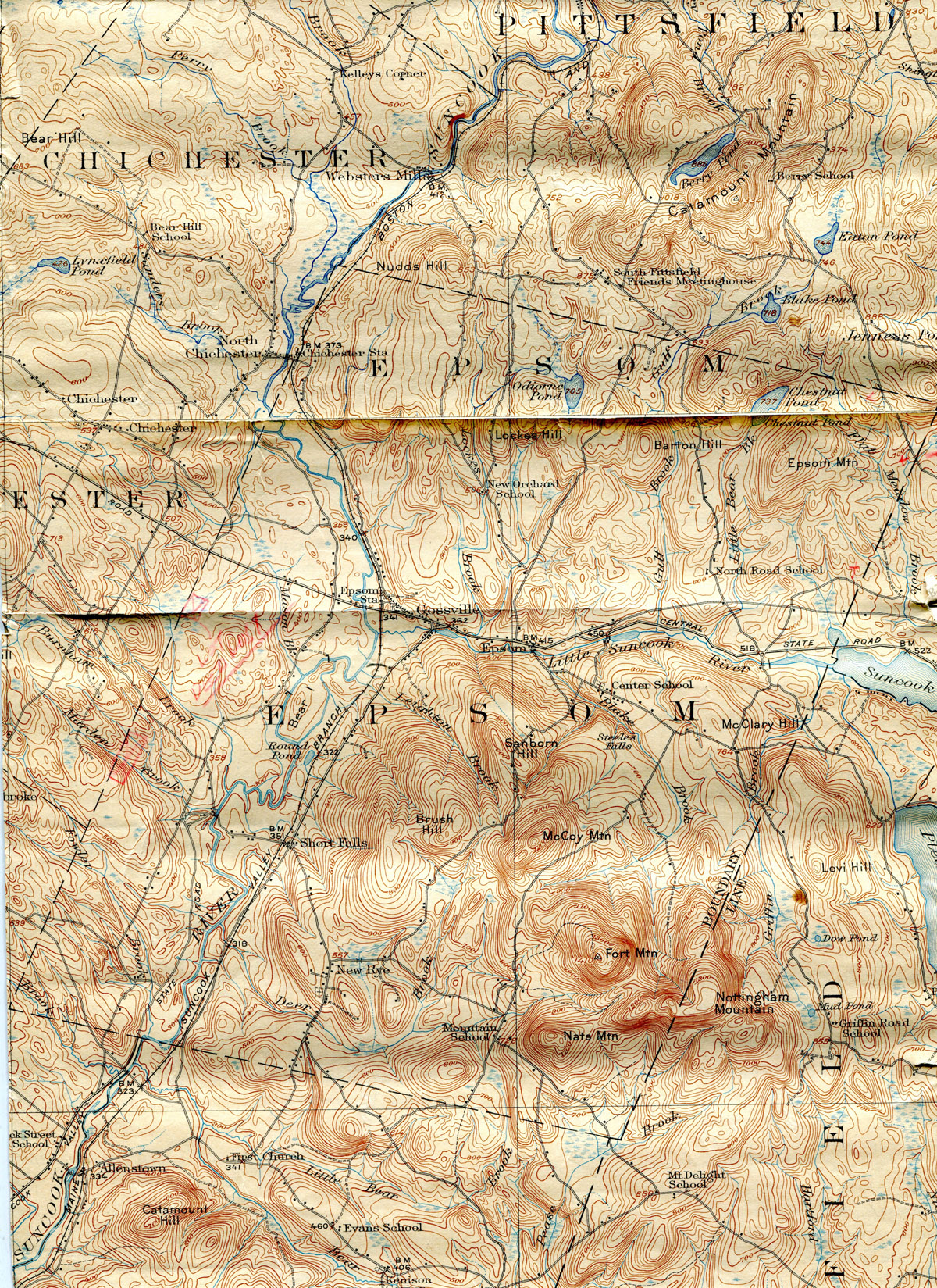
Epsom
1927 USGS map - can be viewed at Historical Center at higher
resolution.
Link
to Epsom Current Tax Map CAI Query Manager (may require
some configuration first time accessed, also issues with Chrome
browser, recommend IE))
Maps
of Lewis 'Perch' Hill - these hand drawn maps by
Lewis Hill are priceless. Not at all to scale, they include locations
that he remembered as well as current occupants about the year 1900.
3 maps; use the pdf controls to reduce map viewing size, recommend
opening browser full screen for best viewing. PDF
format
Map
1 - Goboro
Road and Route 4 with New Orchard Road
Map
2 - Route 4 east of New Orchard Road and North Road
Map
3 - Center Hill and Mountain Roads
* The maps in PDF format
can be zoomed in and out for better detail. Allow time for them
to download - even save them to your computer!
